
Since Mike launched Walking Papers I’ve been fascinated with the aesthetic quality of the scans that people have been uploading. Last weekend, when he and Aaron were down at Camp Roberts working on the project, I asked him to make a change to the way that scans are displayed so that the maps are easier to look at as a group, and as visual & cultural artifacts. Cause, you know, lists are nice, but.
Turns out: he did it, and they’re lovely! (and if you adjust the url parameters you can do things like look at 200 of them at a time, which is nice.)
For me so far the most interesting thing has been the ability to look at the project as a whole instead of as a set of discreet incidents. One day I’ll get my wish of seeing them on a map, but for now, there are 4 categories — could you call them genres? — that leap out:
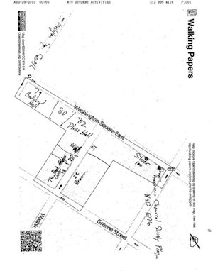
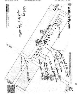
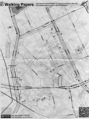
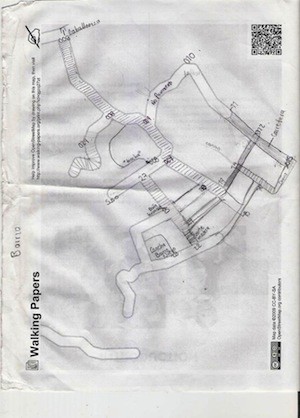
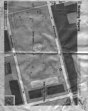
Full:
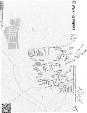
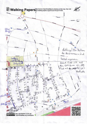
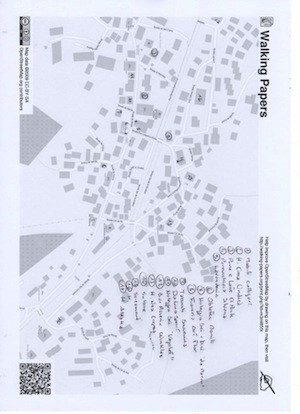
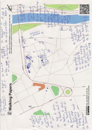
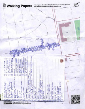
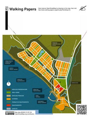
Scans that are just stuffed with notation. There’s something about the obsessive filling in of blocks and gaps that grabs me & makes me think about the whole process that goes into the making of these, over time:
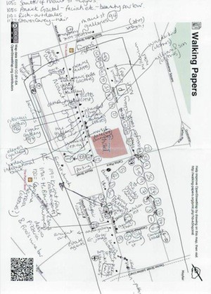
Some of these are dense enough that the authors have included keys in the margins so you can tell what the numbers refer to:
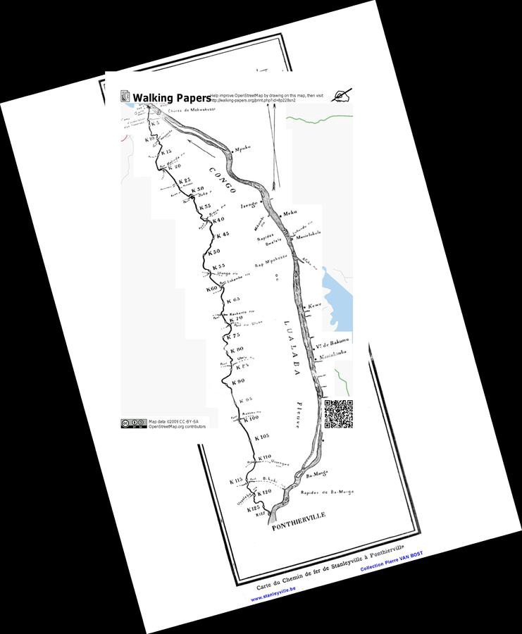
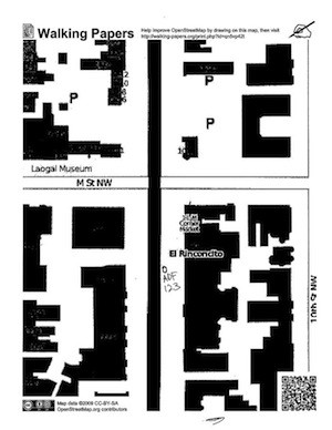
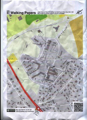
Collaged:
Some people’ve been taking other maps and using the project as a way not so much to annotate the printed-out maps as to easily drop existing maps into the Open Street Map coordinate space. I especially like the first map below, an historic map of the Congo:
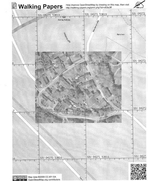
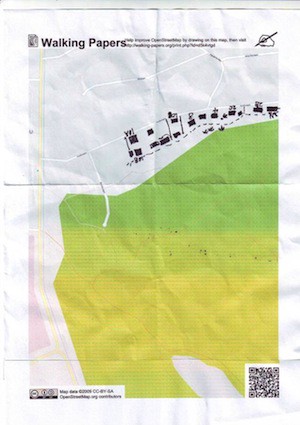
And some have patched satellite imagery in, using them as base maps to (presumably) trace or otherwise use the imagery. Maybe these two are sub-genres:
Faxed:
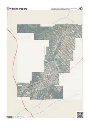
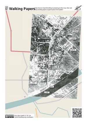
These have been run through some kind of fax machine or scanner, and have all the artifacts of that technology intact:
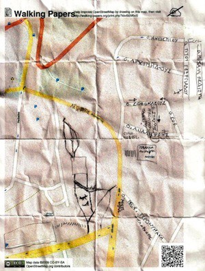
Crumpled:
And visually the ones that leap out at me the most are those for which it’s apparent that there’s a piece of paper here, that someone’s folded and crumpled and perhaps stuck a digital artifact that has some knowledge about where it is embedded in it in their pocket, and really used it:
The intent of the project is mostly about editing the maps and improving Open Street Map, of course — but there’s also a kind of beauty going on here builds on top of that, that comes out of the raw material and allows space for someone’s hand.
I used to describe my notebooks as being about taking a break from the smooth digital surfaces of Stamen’s regular digital work by getting involved in the kinds of markings that hands make. Walking Papers takes this a bit further by providing a way for people to interact with the precision of digital maps by drawing on pieces of paper that know where they are, so to speak.
I still love taking polaroid pictures; there’s something about the fact that this one object was *actually there* when the photos was taken that make it a very special kind of record. My journals often have lemon juice or coffee stains or dirt from a place rubbed into the pages for this same reason. When I look at the crumpled up pieces of paper that are scanned into Walking Papers, or the ones that have satellite images stitched into them, I’m reminded that maps are made, by people, in places, sometimes by hand. I really like that about the project. And there’s a quotidian quality, an accidental beauty that comes from tapping in to a flow and letting it run and choosing the moments where the lovely is.
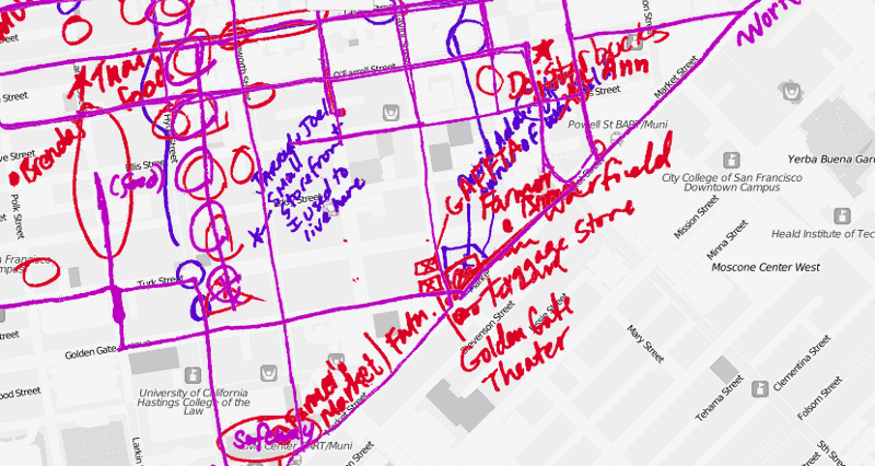
TenderMaps:
This is also probably the appropriate time to talk about TenderMaps, a project that Sha Hwang and Zain Memon (with help from Mike, and others) put together at the Great Urban Hack that happened around the same time at GAFFTA. They dreamt up the idea of telling stories about the neighborhood, got an instance of Working Papers up and running, interviewed people in the Tenderloin and got them to draw on maps, and built a lovely interface for it, all in 2 days. There’s a certain kind of aliveness that I get out of feeling intimidated by smart young people, and these guys scare the crap out of me.
Hyperlinks:
This is also probably the appropriate time to talk about an art and design show we’re participating in at the gracious invitation of Zoe Ryan, at theArt Institute of Chicago called Hyperlinks, which opens on December 12 in the main galleries there. From the Institute’s announcement:
The Internet has undoubtedly transformed the world we live in; its unprecedented access to and layering of information lead to greater interaction and engagement, and a complex understanding of our place in the world. However, this innovative method of accumulating and remixing data is also occurring across the fields of architecture and design. A fluid exchange between these disciplines — fueled by advances in production processes, materials research, social and environmental concerns, and influences drawn from scientific and biological research — is resulting in new attitudes to architecture and design that are opening up these subject areas and stretching their range of influence.
With an eye to these inventive links between practices, this exhibition presents more than 30 projects that span from architecture and furniture to multimedia and conceptual design from an international group of architects and designers, including Florencia Pita/mod, Jurgen Mayer H., R&Sie(n), Experimental Jetset, Emergent/Tom Wiscombe, Arik Levy, Studio Makkink & Bey, Shigeru Ban, Joris Laarman, Nacho Carbonell, and Matali Crasset. Not always intended as ends in themselves, these multidisciplinary practices are often experiments that motivate reflection on the values, mores, and practices often overlooked in society. Projects such as Nacho Carbonell’s 2009 Lover’s Bench poetically explore private and public space, while the design studio Stamen’s 2010 social mapping project, Walkingpapers.org, provides a public forum for updating online information. Architect Keiichi Matsuda’s 2009 film Augmented (hyper)Reality: Domestic Robocop investigates the potential of environments enhanced by advanced technologies, and Troika’s 2010 Plant Facts Plant Fiction demonstrates the possible ecological benefit of natural and artificially generated species of plants. Hyperlinks also includes specially commissioned works such as inventive new furniture elements by architect Greg Lynn and a multimedia project by Simon Heijdens that attunes the ambience of an interior space to exterior climatic conditions.
Diverse in perspective and output, the works included in Hyperlinks make clear that by fostering rigorous cross-disciplinary relations, architects and designers are carving out new avenues for experimentation that are helping shape insightful solutions to urgent issues, ultimately enhancing the quality of our daily lives.
The show starts on December 11, and a few of us are heading out to see it, so if you’re going to be in (brr) Chicago in mid-December, please get in touch. And there will be some educational events taking place around the project starting in January that I’ll post more about as we know. Thanks to everyone who’s participated in the project so far!