
On April 11 and 12, the Interior Department held its first-ever hackathon. The topic was one that’s close to our hearts: Parks! The myAmerica Dev Summit attracted people from all over the country interested in parks and code, and especially the new Recreation Information Database API (RIDB).
Two Stamen folks went to the hackathon and worked on two things, both aimed at better telling the stories of parks through open data and social media.
First, we brought along a dataset of links to about 77,000 Flickr photos harvested from within parks (using the tools we built forCaliParks.org). Those images came in handy for another team at the event: The folks from Booz Allen Hamilton built an awesome WanderList site to search the RIDB parks and show flickr photos in those parks (here’s their code).
And second, we worked with our friends at Trailhead Labs to figure out efficient ways to both improve trails data in OpenStreetMap and increase agency engagement with the OSM community. Here’s more on that front.
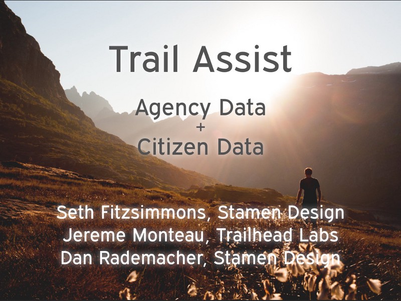
Trail Assist: Agency Data + Citizen Data
Our goal over the weekend of the #dev4outdoors hackathon at the Department of the Interior was to make substantial progress on adding detail and texture inside the 3,000+ parks in the Recreation Information Database (RIDB).
The RIDB gets you point locations and more than 40 text attributes like “camping” and “paddling.”
But where exactly are those amenities? And what do those parks actually look like? People visit parks not for the point at the other end of a driving route but rather for the rich experience they’ll have when they get there.
They’re going to want to know what that experience is before they get there. And once they’re, they want a good map.
When faced with thousands of parks, we think social media and open data are key resources to not only fill in the gaps but also show the diversity of experiences you can have in parks.
So, how to fill in a map of thousands of parks?
Ask all the people: Agency staff, park volunteers, OpenStreetMappers, social media users. Fill in the details of the park with help from social media and crowd-sourced map data!
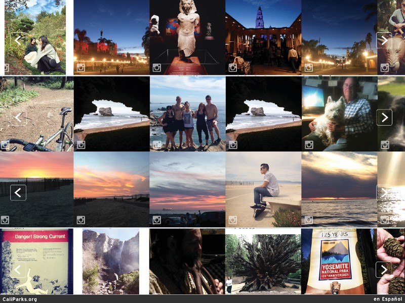
On Caliparks.org, we harvest Instagram photos to show how people experience thousands of parks:
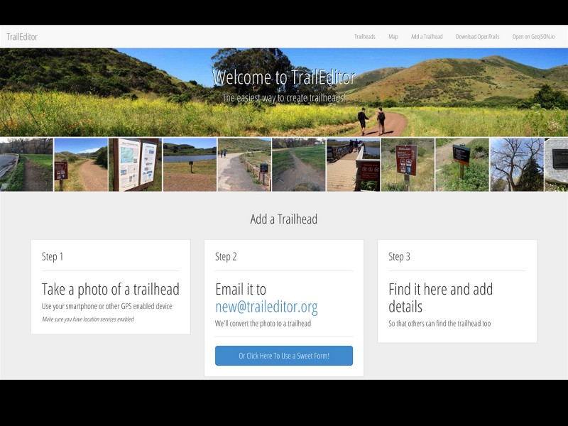
Trailhead Labs built the open source traileditor.org so people can email in photos of trailheads, to build a crowd-sourced trailhead database with images and detailed information:
But crowdsourced data is not without its challenges. It can work amazingly well at scale, but it can also be wrong.
That’s where Trail Assist comes in. We propose to make it easier than ever for the parks community, including park visitors, to report and flag bootleg trails (also called social trails or even desire lines). The system can also help agencies improve their own data.
First, email a photo of the suspected bootleg trail to social@traileditor.org, and that will add it to the TrailEditor site.
Then we provide some information about what bootleg trails are and why we should be concerned about them.
But more important, we push that point location to OpenStreetMap (OSM), the largest and most detailed publicly accessible map of the world ever made.
That information then appears on OSM and alerts agencies or volunteer mappers that they should inspect the area more closely.
For that, we’ve begun developing tools that make it much simpler to see where open data and official data differ.
Working within the open source Java OSM editor (JOSM), we used some tools built by Stamen (the backend of Map Stack) and API integration with CartoDB to make a view like this:
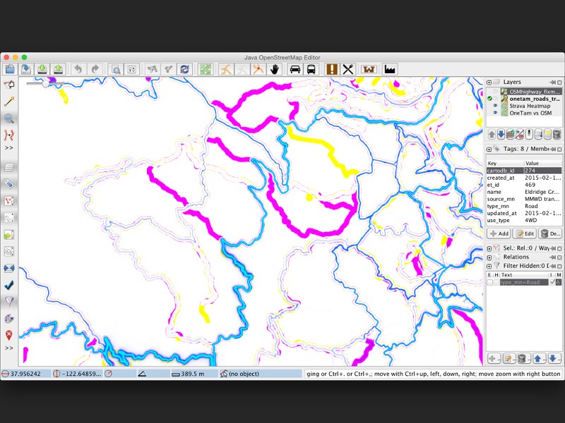
The yellow is agency data. The magenta is OSM data, and the variable blue lines are the Strava Global Heatmap. We use layer compositing blend modes to make yellow and magenta cancel to white, and then layer on the Strava map, making it instantly obvious which trails are most likely to be social trails and which of those are most heavily used.
Bringing richer trails data into the OSM community
One of our key goals is to improve data within OSM in a way that is true to the community that makes the map, and therefore gets owned by volunteer mappers, vastly increasing the likelihood that data quality will be maintained and improved over time.
While we worked on-site during the hackathon, we engaged in a larger conversation (via Slack and social media) with members of the OSM community about trails and trailhead data. Brandon Knight (@geobrando) published a detailed proposal for a new standard for defining trailheads within OSM.
That inspired community discussion (so far, 20 responses in the community thread), and a clear, succinct definition (in our opinion) emerged: A transition point between a trail network and the developed transportation network of roads, mass transit, etc. (See the start of the discussion here.)
In our work at the hackathon, we also began circulating a proposal for a new social_path tag to clearly mark areas where trails exist that aren’t part of the official trail network.
Our goals for this proposal are twofold: to enrich the data already present within OSM and to facilitate exclusion of such trails. Deleting unsanctioned trails is problematic, as they clearly exist in the real world.
Like roads, most trails fall under the responsibility of a government agency that designates the permitted uses of a trail (whether horses or bikes are allowed, for example), and they also determine when a trail should not be used, particularly if there are safety or environmental considerations. The trail still exists, and (rather than deleting it) we can further specify its characteristics within OSM.
Beyond preventing edit wars, we attempted to come up with a scheme that would facilitate easy exclusion of the data from most maps (to discourage use in the real world) while remaining available for cases when such data is legitimately useful (e.g. for evacuation or firefighting). Within the OSM community, such tagging could be considered “tagging for the renderer” (since there’s a clear intent to influence how they’re displayed, and this is generally discouraged), but we prefer to look at it as being akin to describing the precedence and use of roads using highway=tertiary, highway=service, etc.
As with roads, not all trails are equal.
For developers of websites and apps for parks, there’s a huge benefit in using OSM as a (free!) one-stop-shop for data regardless of jurisdiction. In fact, the benefit is so huge that developers will keep doing it. Even if the data is wrong.
Better to make the data right AND provide easy tools for hiding or marking prohibited trails. So let map designers query for trails wherehighway != social_path and they get to serve better data, while agencies get a clear path to better maps across products they might not even know about and the open data community gets more accurate data.
What’s next?
- Enhance the proof of concept to more easily incorporate data from any source.
- Investigate potential integration with the NPMap team’s Places Editor modifications to iD.
- Work with the OSM community and local agencies to propose and drive adoption of a social trail tagging norm.
- Organize a grassroots Trail Blitz in the Bay Area to field test the tools.
- Field test the tools with data from local agencies.
- Package up the tools for use by others.