
As I’ve done before once or twice, I got excited enough talking about the projects we’ve been working on that I ran a bit over during my talk today and didn’t get to the questions I wanted to ask the lovely audience at Webstock to help me answer. Suddenly there was a “0 minutes left” sign (woulda been nice if that were bigger and brighter, you guys), and boom! tIme to turn it over to Robin Sloan who said about the Big Black Mariah what I’ve had in mind for some time, of course much better than I ever could.
As I said, I’ve done this once or twice before, but these questions are important enough to me that I’d like to get them out in public so I take them seriously. So — bearing in mind that this was intended to be narrated by me, is super-early in their cogitation and public discussion — here’s the question part of my talk in pdf format. For those not in a downloading mood, here are the basic questions, & some screenshots.
1. how things look: now & then
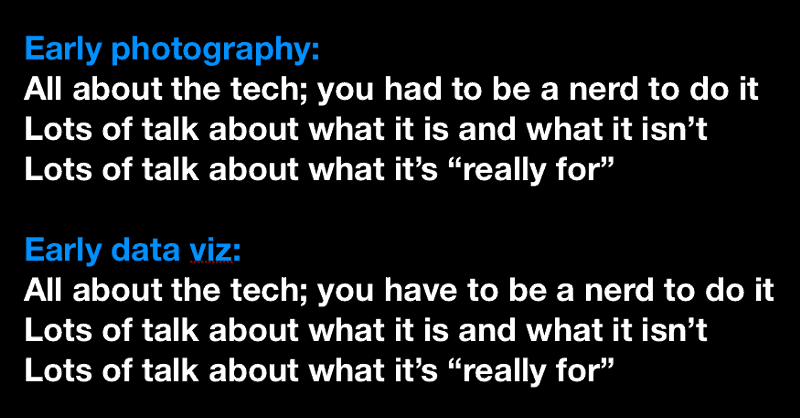
Mapping and data visualization today look a certain way. They look, in some ways, like early photography used to look, and here’s why:
- Both are all about the tech; you ve to be a nerd to do it
- There’s lots of talk around about what it is and what it isn’t
- There’s lots of talk about what it’s “really for”
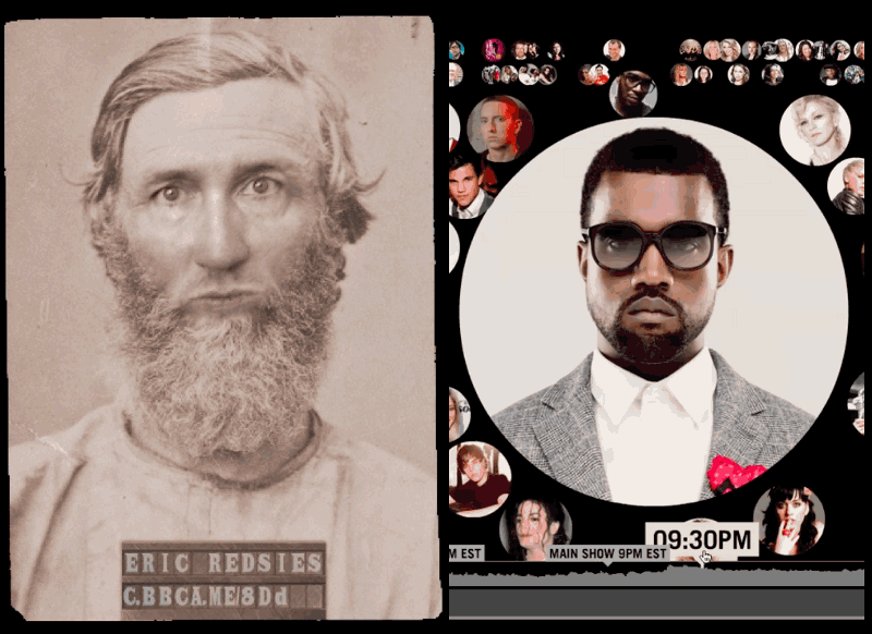
Let’s get specific: Twitter visualizations, pretty soon, are going to look as archaic as this picture of me in jail in 1895:
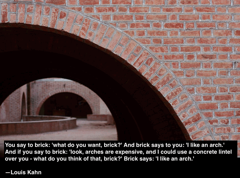
There’s also Louis Kahn that I want to finally think about in public. “You say to brick: ‘what do you want, brick?’ And brick says to you: ‘I like an arch.’ And if you say to brick: ‘look, arches are expensive, and I could use a concrete lintel over you — what do you think of that, brick?’ Brick says: ‘I like an arch.’ “ There’s something here about digital media, especially as we get a better sense for what the form of the medium is like, moving out of the early days of photography/data.
So my question for this one is: Where else can this analogy go? I think Robin Sloan probably has a stack of answers and I hope we get to talk.
2. why do they things look the way they look: whose hands build them?
- National Geographic maps: they look as if they were made by hand, and they are.
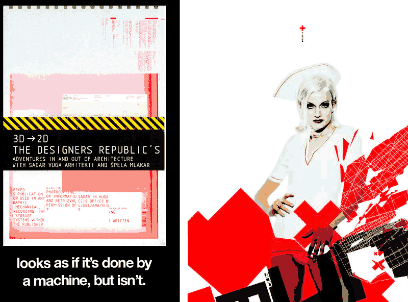
- The DesignersRepublic: their stuff looks like it was made by computers, but isn’t
- Google Maps: looks as if it were done by a machine, but it isn’t.
- Apple Maps: looks as if it were done by a machine, and was!
- Watecolor Maps: looks as if it were done by a person, but isn’t
So my question for this one is: if our most salient work is made by hand with robots, what else is like that? What else will be?
3. what magic — literal magic — happens when you leave the cameras on?
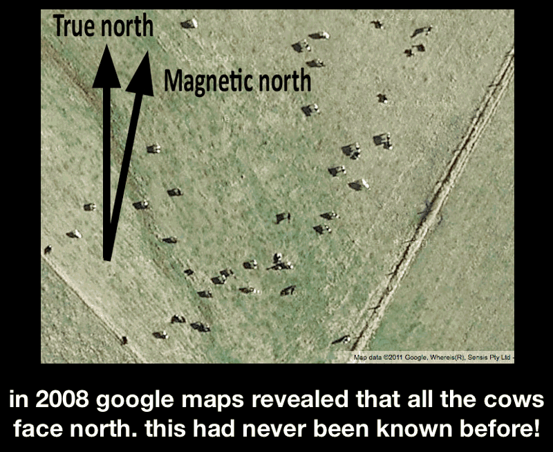
In 2008 google maps revealed that all the cows face north. this had never been known before! It was because google left the cameras on and made them all available.
http:/kepler.nasa.gov does this with the night sky: leaves the lens on, discovers planets. My question here is: what else gets captured when the camera gets left on? what else can we learn?
4. delight & utility: gardens, farms, beer
Beer comes before agriculture. Gardens too. There are too many generational steps involved between grasses in their natural form and wheat worth harvesting for agriculture to be the thing people were shooting for when they domesticated plants. Drugs and beer and pretty flowers, on the other hand, can be made from a single generation of garden from wildflowers.
We talk all the time about data visualizations and maps that are useful. We don’t talk at all about data visualizations and maps that delight you and make you laugh. We should
For this one, I don’t have a question so much as I want to say this in public: delight precedes utility. Cool is necessary before useful comes along.
And so
I know it’s raw, but people asked. If you’re in a talking mood, you can find me on twitter and people are tagging their responses with#webstock. OK!