When I first discovered Pinterest about two years ago, my heart exploded and my mind was blown in the best possible way. One simple interface allows me to visually browse all of the beautiful stuff I find on the internet and beyond, and to organize it how I please. It feels friendly & welcoming — a place where I know I’ll find good things to look at and that I carefully put things I want to use later.
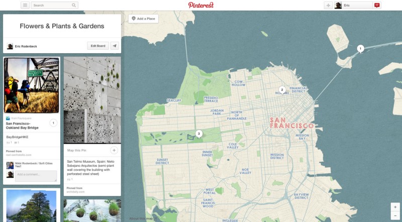
So you can probably imagine the heart-explodiness that’s rolling through my corner of the studio this evening, with the release of Place Pins, featuring a beautiful new map designed by none other than us! Place Pins let you map the things you love, near and far, making the pins more actionable and bringing out the explorer in all of us. You can view and create these Pins on your desktop or on mobile, when you’re actually out and about exploring. You can also collaborate with friends and family, using it to plan your next vacation or a tour of your favorite architecture.
Making a map fit for this kind of activity was a fun one. Pinterest loves color and texture and a feeling authenticity, all of which you might find in a paper map. Our house style, to the degree that we have one, tends to veer towards the bright and sparkly, and this design challenge was the perfect opportunity to break from our mold and try something new. Which we did, using rice paper texture, subtle color washes, and a mixture of unicode and hand-drawn fonts. We’ve also added some extra touches, like using OSM ids to introduce just a bitof entropy into the angle of all of the place labels to introduce some variety and get away from the hyper-precise default modern way that these things tend to settle towards. If you look carefully you’ll notice that the spacing of the letters on street labels varies a bit from road to road. This is an intentional gesture towards making maps more human. The result is a map that (we hope) has a bit of soul and variety to it, not just another one-off, and is just asking for pins to be put all over it.
I’m also pleased to announce that for the first time we’ve shifted the backend infrastructure burden of one of our projects to that developed by our colleagues at Mapbox (you can read their take on all this here). The whole process of getting this thing online and polished was incredibly smooth and hassle-free, totally different from the wailing & gnashing of teeth that historically has accompanied the release of our worldwide maps. Honor is due to those guys for solving a hard problem and for making it possible for this kind of project to flow smoothly. I’ll follow up in a separate post about some of the finer details we included in the project and some ways that I think things could get even better.
All in all, we’re delighted to have been asked by Pinterest to participate in this project, and we hope the results are to your liking. Let us know what you think, and we hope you’ll share your maps with us and others. And happy Place Pinning!
Ze Maps:
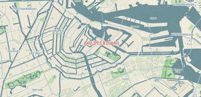
Here’s the city view of Amsterdam. At this particular zoom level, the small details of roads and buildings amplify the textures that are being used for land and water.
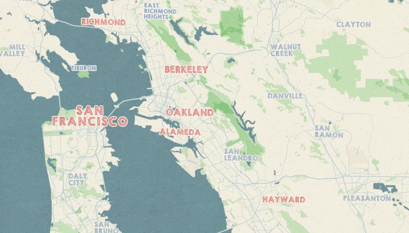
The Bay Area. At this zoom level, we start to see the emergence of parks, as well as major roads. These elements, along with the textured waterways, reveal many layers of detail that work together quite beautifully.
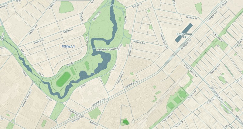
The street level view of Boston is shown below. Here we see a nice combination of road labels, buildings, parks and waterways.
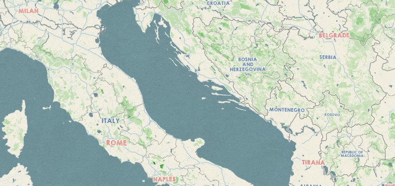
At the country level, a large portion of Europe is captured in this image. The forests become visible, giving the landscape another layer of texture.
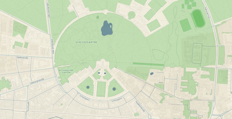
Karlsruhe, Germany. At this street view, we see several detailed components, such as parks and foot paths, rail lines and building density.
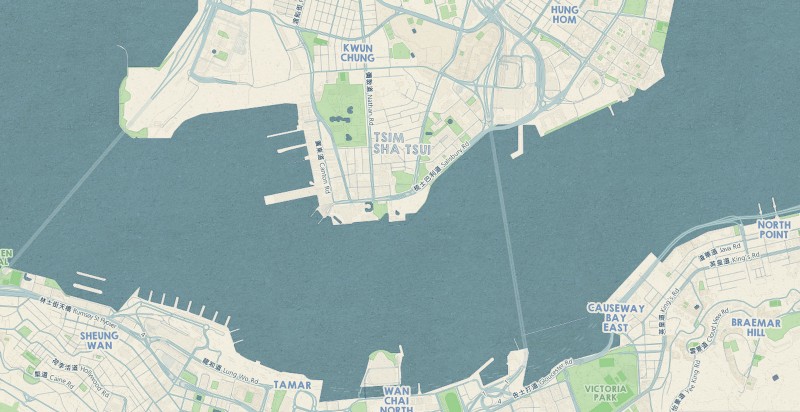
Hong Kong captures one of our main design goals with the Pinterest project. The “hand-crafted” look and feel is quite evident with the contrast of textures, especially where the water meets the land.
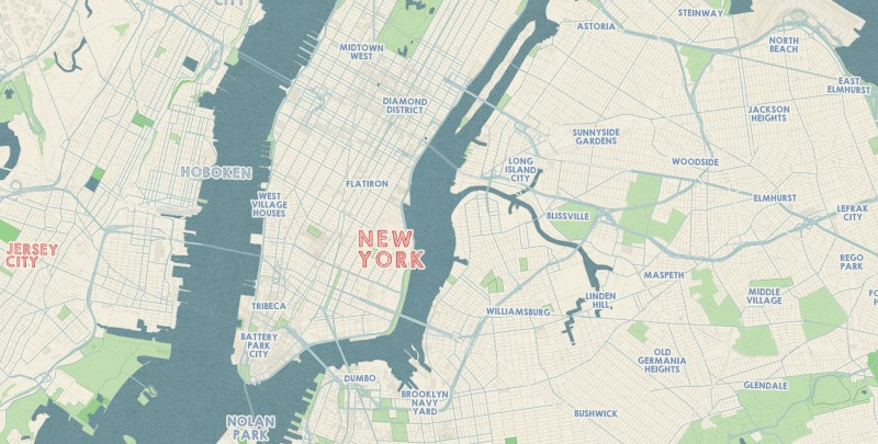
Manhattan and the surrounding boroughs. Like the image of Amsterdam, this zoom level captures several detailed elements — roads, highways, waterways, buildings and parks.