
At Stamen we use OpenStreetMap data in most of the maps we make, including our Watercolor, Toner, andTerrain map tiles. OpenStreetMap is a rich and growing dataset that has been created and maintained by hundreds of thousands of volunteers around the world, and at Stamen we wouldn’t be able to do what we do without it.
But it can be hard to visualize the immense amount of work that goes into building and refining a complex dataset like OpenStreetMap. As part of my dissertation research at the University of British Columbia — research that feeds into the work I am doing here at Stamen — I have been looking at the historical OpenStreetMap data to see how the project has grown and evolved over time.
To this end, I created some visualizations of historical OSM data called OpenStreetMap: Every Line Ever, Every Point Ever
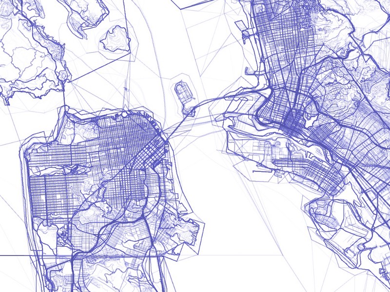
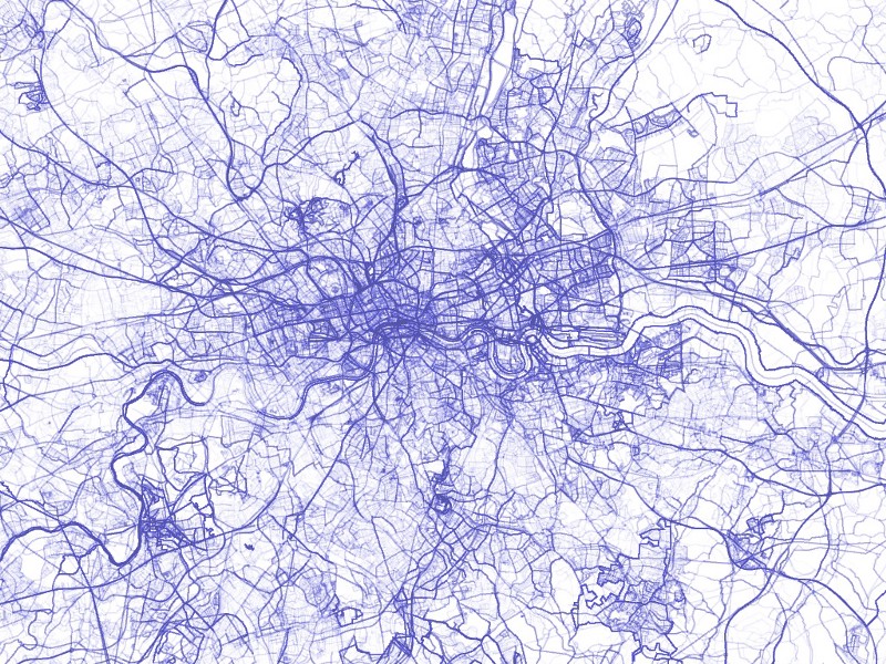
The first map, “Every Line Ever”, starts from a simple premise: draw every version of every linear feature present in the OpenStreetMap historical data, even if those features have been subsequently deleted. Each line is drawn at 1% opacity, such that areas where multiple linear features are present or where multiple versions of a single feature exist, the lines drawn on the screen will accumulate to produce a darker and darker mark. The result produces a map that is strikingly familiar and readable: freeways appear more prominent than city streets, which are in turn darker and more visible than alleyways. However this hierarchy is not derived from any attributes associated with those features; rather, the hierarchy emerges naturally through the cumulative traces of OSM contributors modifying and refining the map. Inevitably, the features that are important to more people are edited more often, thereby becoming darker traces on this map. On further inspection, it is possible to see how the ghostly initial sketches of some features gradually coalesce into thicker, sharper lines as the collective effort of OSM volunteers settles around a consensus.
Here is the same approach, applied to London, England, where the OpenStreetMap project began:
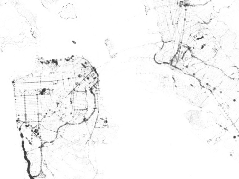
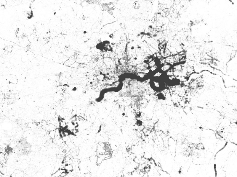
The second map, “Every Point Ever”, follows a similar approach, but using the point features from the OSM history database. In this case, every version of every point is drawn on the map at 1% opacity, but in this map the points are also scaled according to their version number. Thus, a point that has been edited a dozen or even a hundred times will be drawn again and again on the map, represented as an increasingly larger circle. Points that are continually modified in the OSM database will appear to “bleed” onto the page in this map. Where the first map evokes the spidery traces of pencil drawing, this map appears more like a collection of inkblots. Both maps use these metaphors of hand-drawn illustration to reveal the historical traces of effort that normally go unseen when looking at a finished map.
Be sure to try out the interactive version at http://graphspace.com/every-line-every-point which allows you to zoom in and see more detail.
I’m also delighted to say that this project won first place at UC Berkeley’s map exhibit called “See-Through Maps: Maps that lay bare their point of view”, which was part of the Mapping and its Discontents symposium hosted by the Global Urban Humanities Initiative. Please take some time to peruse the other maps in the exhibit; you’ll find a wide range of innovative and beautiful maps, and I was proud to present Every Line Ever, Every Point Ever alongside them.