
In 2010, Stamen was awarded a Knight News Grant to build tools that help people tell better stories about cities. I’m pleased to announce that we’ve been awarded another grant from Knight to extend and support this project, as follows:
- Terrain layers, at all zoom levels, outside the US
- Transfer the hosting and processing to a cloud-based infrastructure to increase stability, scalability, server response and service levels, creating more reliability and confidence for those considering using the tile sets, & to allow for more frequent data updates
- Improving the accessibility and openness of the code base for the whole system
All too often, foundations and granting organizations get excited about funding new projects, without adequately considering how to support them once they’ve been launched. It’s great to see Knight stepping out of this mold; Chris Barr and John Bracken are thinking about the future and it’s great to have their continued support.
The project is used all over the place, which is great to see. Seth reports that we’ve served 329 million tiles since July 25th of this year, and 277 million in August so far.

This announcement comes at the same time as we’re announcing a fairly substantial update to the project, Toner in particular. We’ve moved the infrastructure for the project off of Tile Farm, the communal server in Zynga’s basement, and it’s now living entirely on production-quality servers “in the cloud”. We’ve worked out how to reliably import a whole planet’s worth of data from Open Street Map, so you’ll start seeing much more up to date data moving forward.
The new Toner also contains some significant design updates. The repo is open source as usual, at https://github.com/stamen/toner-carto. But the real pop, for me, is to see how far OSM has come since we last published it. There are so. many. more. buildings! And lakes and rivers and streams and detailed canals and quays and on ramps. The project is just continuing to seriously kick ass, and it’s amazing to really dig in to what the army of volunteer mappers who make it happen have been up to.
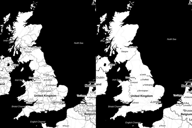
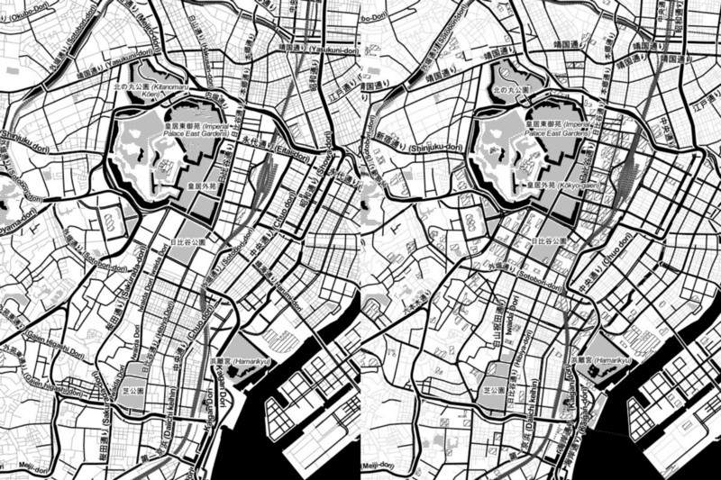
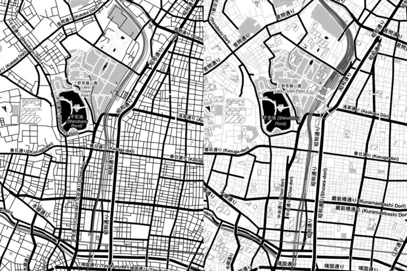
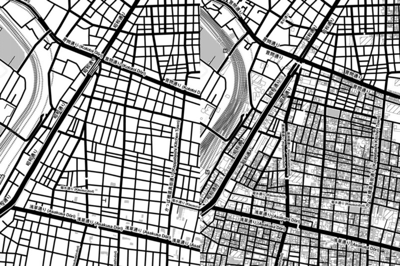
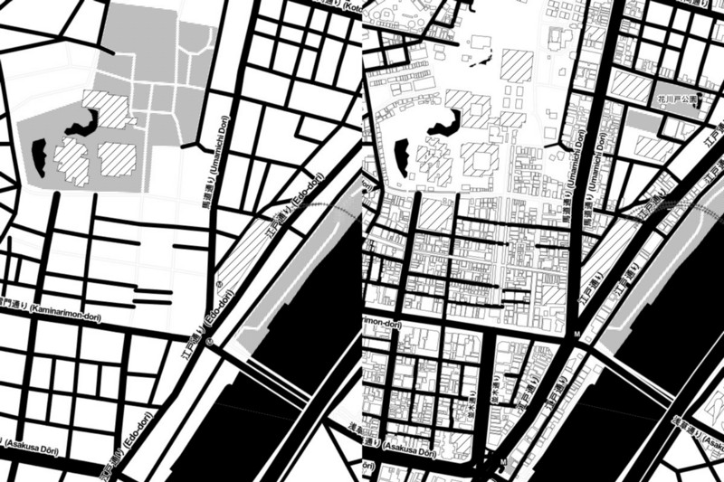
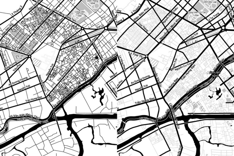
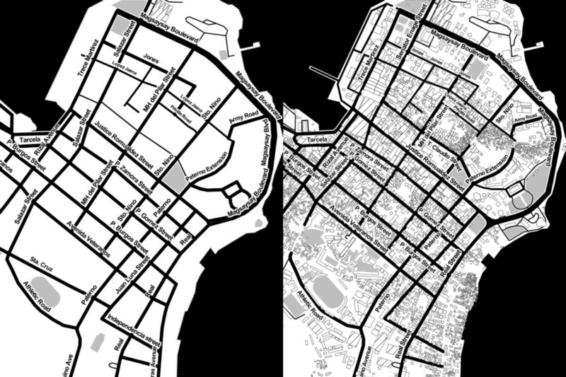
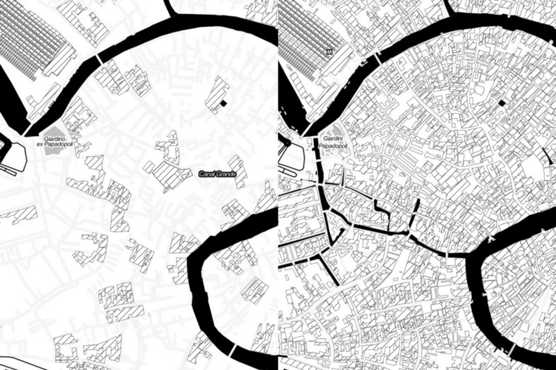
In the following screenshots, the old Toner tiles are on the left, and new Toner is on the right.
At lower zooms we increased the detail on the coastlines, which will look really sweet on retina displays. Also note South Sudan has been added:
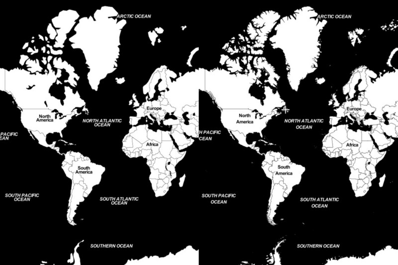
We improved which borders are displayed. Old Toner wasn’t showing the borders between England, Scotland, and Wales. Now, that’s all we show at this zoom level, and we wait to display smaller subdivisions until you zoom in further:
We use OpenStreetMap at higher zoom levels, and there has been a lot of improvement in the last few years.
The old Toner data was from early 2012, before OpenStreetMap’s license change from a Creative Commons Share-Alike license to theOpen Database License (ODbL).
Tokyo, Japan shows a lot of improvement, both in the data and how we style it:
Ho Chi Minh City, Vietnam shows new roads, but also how the styling of existing roads has improved. The neighborhood streets are more subtle at this zoom level.
Tacloban City, Philippines, now has much more detail thanks to the humanitarian mapping efforts during Typhoon Haiyan/Yolanda
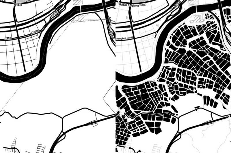
Ponds in Shenzhen, China
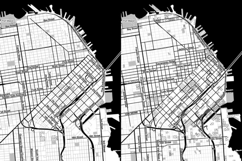
A lot of cities in the US now have complete coverage of buildings. We’ve adjusted Toner’s settings so that large buildings show up sooner as you zoom in. For example, in San Francisco, California you can see many more buildings at zoom 14, especially in the former industrial district of Soma.
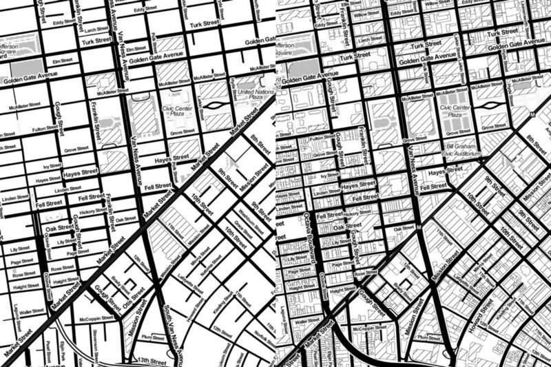
By zoom 16, you can see all the buildings.
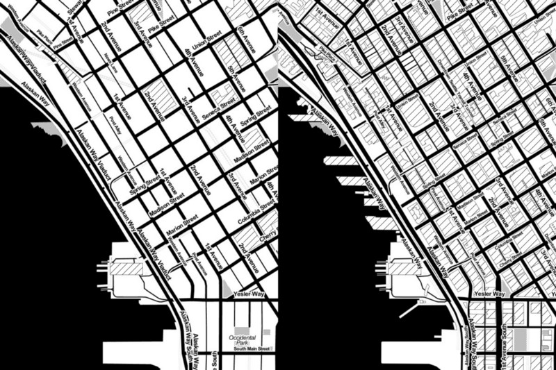
Seattle, Washington also has every building in OSM.
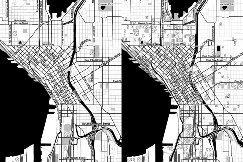
Notice the improved detail along the waterfront.
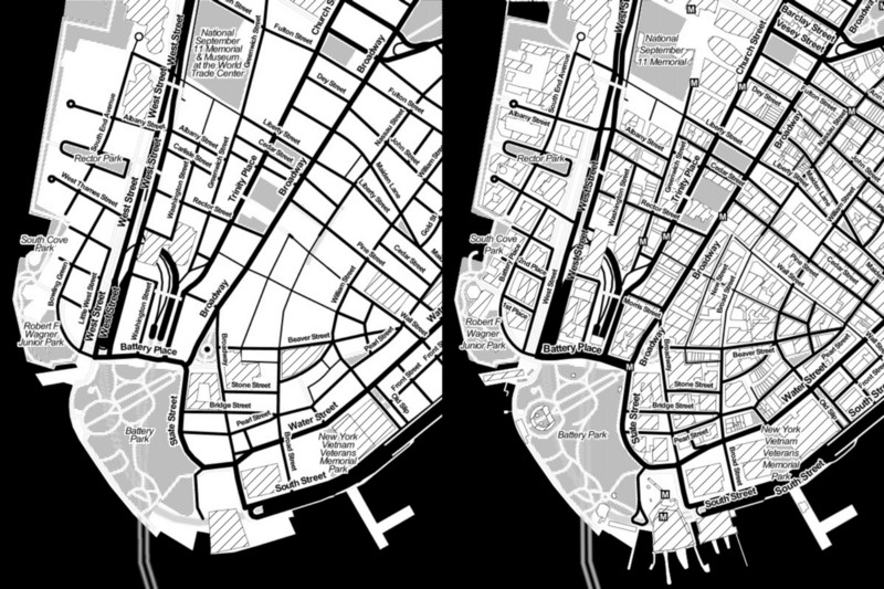
New York City now has every building, too. And look at those piers!
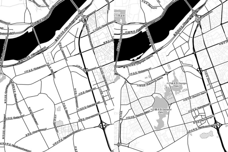
Seoul, South Korea has more streets and buildings in the center of the city
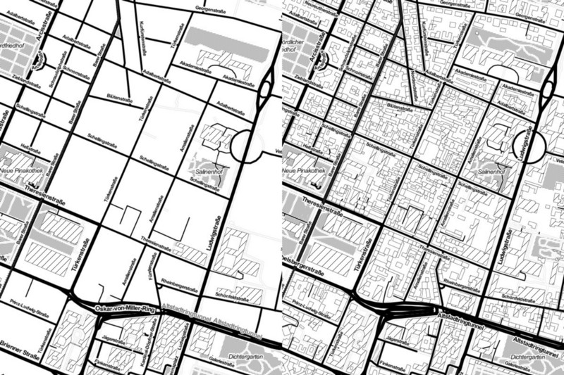
Munich, Germany
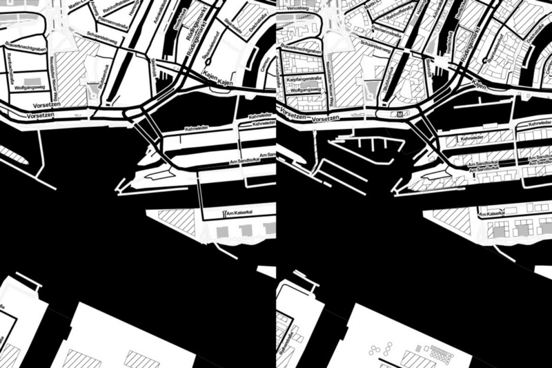
Look at the detail in the harbor of Hamburg, Germany
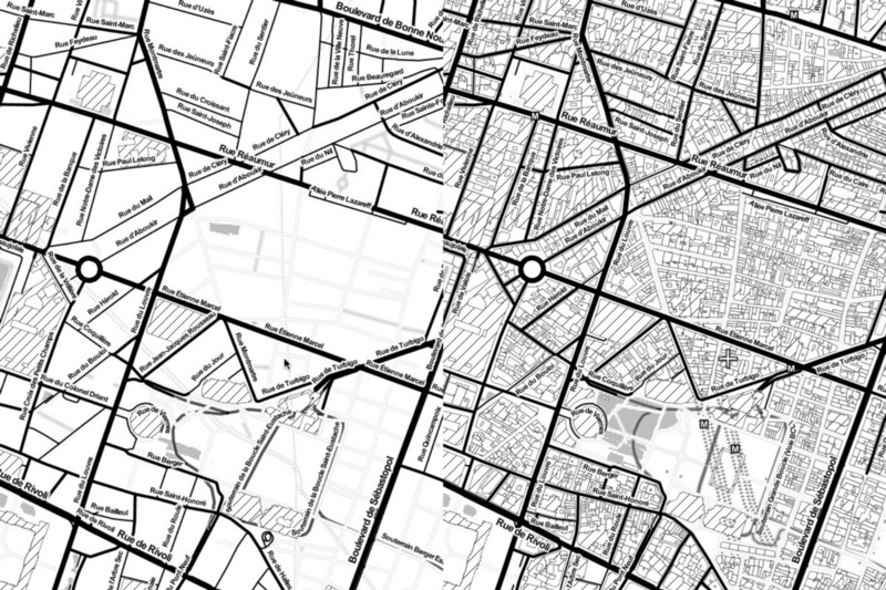
Paris, France
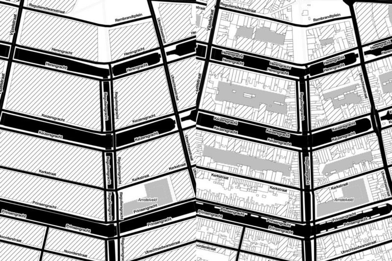
Amsterdam had a lot of building footprints before, but look at how much detail there is now!
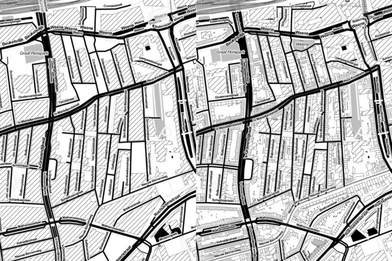
More detail of individual buildings in Rotterdam, Netherlands, too:
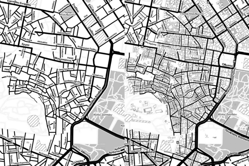
You can now see the Parthenon in the Acropolis of Athens, Greece, along with thousands of other buildings
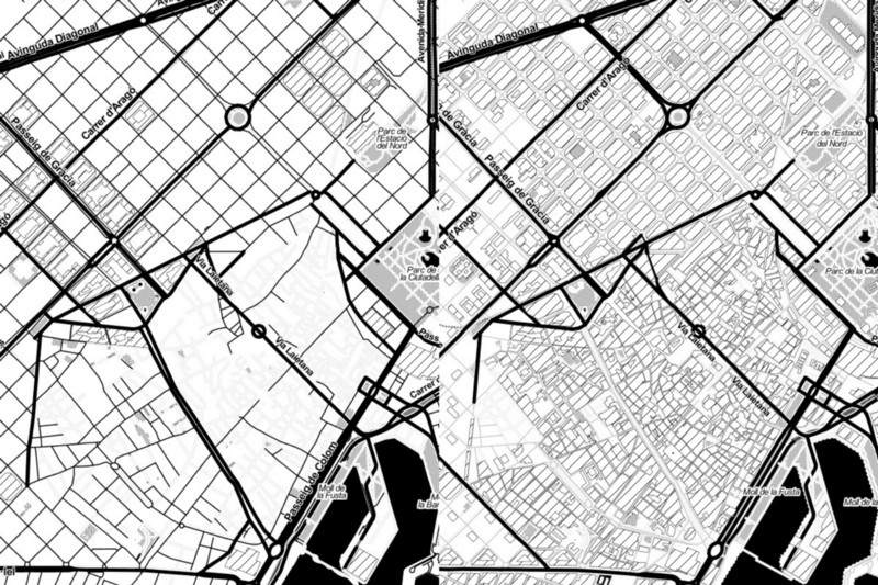
Barcelona, Spain
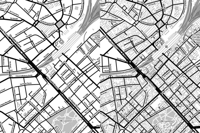
Rome, Italy
Canals are now visible in Venice, Italy
Enjoy the new project, and if you’re interested in learning more about how this work will be extended, you can follow along on GitHub.