All Posts

Eric Fischer’s photos on Flickr

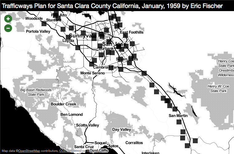
One of the great things about Eric Fischer’s map experiments on Flickr is that he actually takes the time to geolocate everything. So if he’s making, say, a map of where people tweet vs where they upload photos in Montreal, the photo will tell you that it was taken in Montreal. Or if it’s he’s scanning a plan for the freeway design of South Valley Freeway, Highland Avenue to Day Road (1959), it’ll actually be in between Highland Avenue to Day Road.

Which means we can make maps in Dotspotting that look like this:
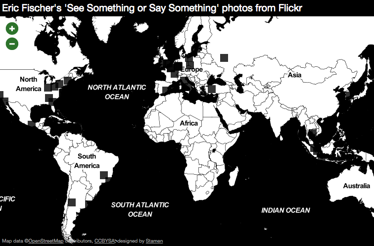
Eric Fischer’s ‘See Something or Say Something’ photos from Flickr on Dotspotting

And like this:

Trafficways Plan for Santa Clara County California, January, 1959 by Eric Fischer on Dotspotting

(thanks to Sha Hwang for providing the impetus for this post)

Published: 07.20.11
Updated: 09.20.22

About Stamen

Stamen is a globally recognized strategic design partner and one of the most established cartography and data visualization studios in the industry. For over two decades, Stamen has been helping industry giants, universities, and civic-minded organizations alike bring their ideas to life through designing and storytelling with data. We specialize in translating raw data into interactive visuals that inform, inspire and incite action. At the heart of this is our commitment to research and ensuring we understand the challenges we face. We embrace ambiguity, we thrive in data, and we exist to build tools that educate and inspire our audiences to act.