
Close readers of Aaron’s blog and flickr stream know that he’s been thinking for some time about making maps out of things that people do, whether it’s geotagging photos or tracing streets or deriving urban areas from analysis of satellite photos, and posting his experiments with them as he goes. I’m zazzed (thanks AG) to announce that he’s racheted up of this effort into a combination of — wait for it — four different datesets into a cracklingly lovely pastiche, available for your perusal athttp://prettymaps.stamen.com.
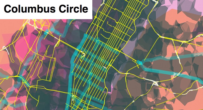
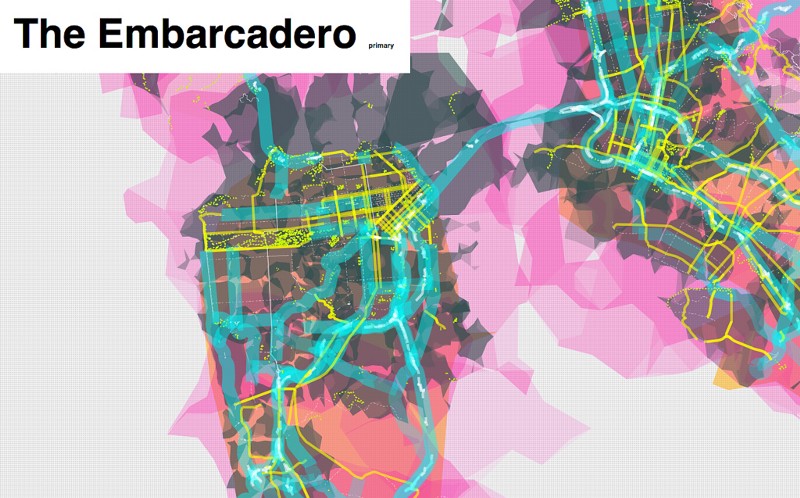
The thing to watch here — besides the lovely, and also that this experiment is likely to make your browser cry for a while until we work out the kinks — is that, at certain zoom levels and in certain places, the things on the map are addressable on rollover. Which is to say: they’re not pre-rendered graphics that are cooked down into tiles for easy delivery, but actual shapes, actual streets, actual areas that can be individually targeted and messed with. So when it says “Columbus Circle” in the map above, and “Embarcadero” in the map below, that’s because things called Columbus Circle and Embarcadero both are actually on the map, and not pictures of them, if you get my meaning.
Everything you see in the image above — every dot, every shape, every blue road, all of it — is its own special snowflake, with its own unique properties, right in the browser — and we’re only just beginning to understand what that might mean.
More on this as we go — and hopefully the servers will stay up overnight, but in the meantime, enjoy!